Topographic maps and plans – the basis for the development of your settlement!
We offer the following types of work:
01
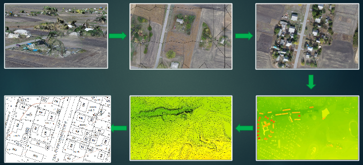
Creating digital vector topographic plans of scale 1: 500 - 1: 10 000
02
Update topographic scale plans 1: 500 - 1: 10 000
03
Vectorize existing topographic plans of any scale
04
Adaptation of vector maps and plans for urban planning tasks; creation of large, medium and small scale topographic maps of scale 1:10 000 - 1: 100 000
05
Creating custom plans for settlements of scale 1:10 000 - 1: 50 000 with color division for industrial printing
06
Creating thematic plans and schemes for special tasks and different territories (for example, population density plans, real estate or land allocation schemes, service location schemes, and more)
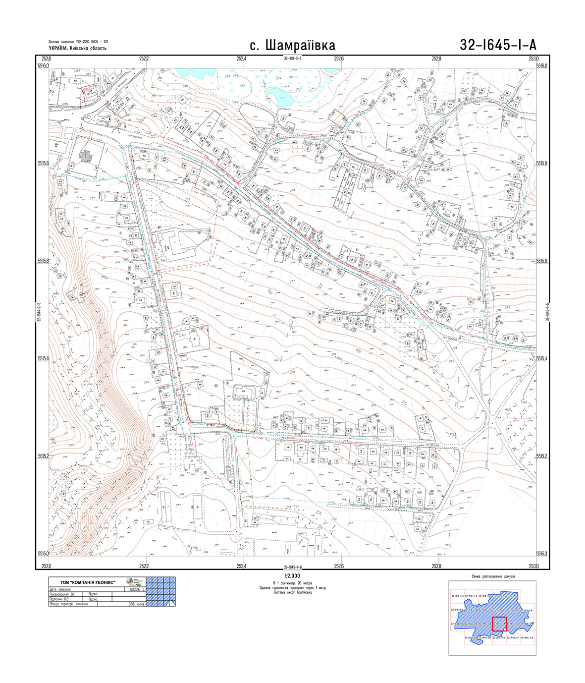
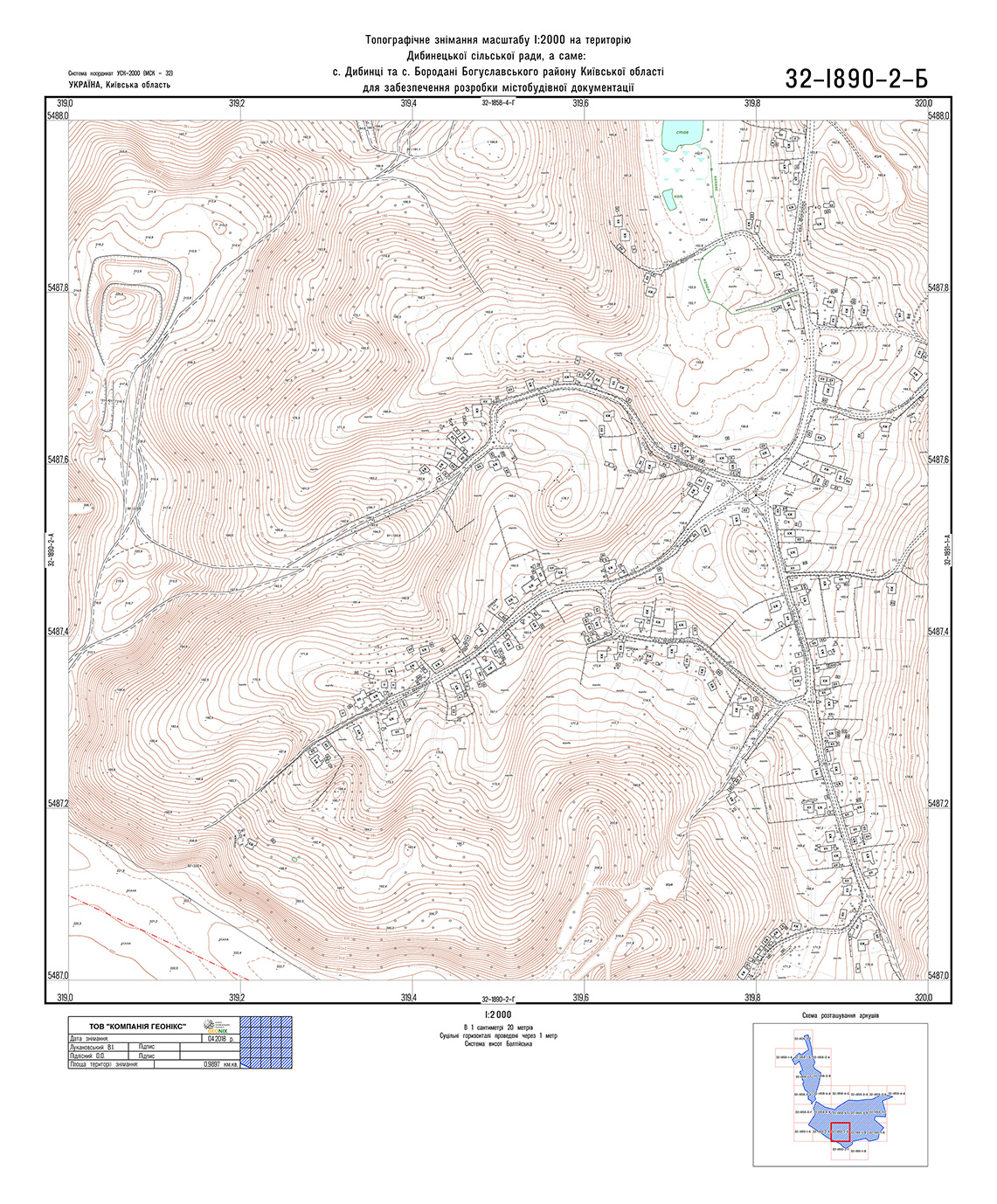
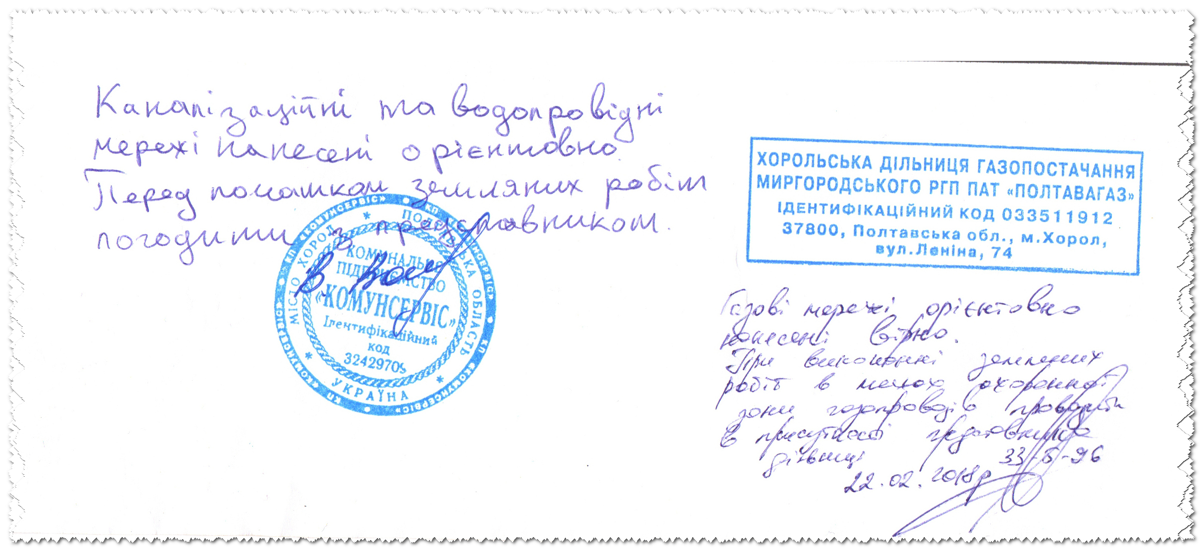
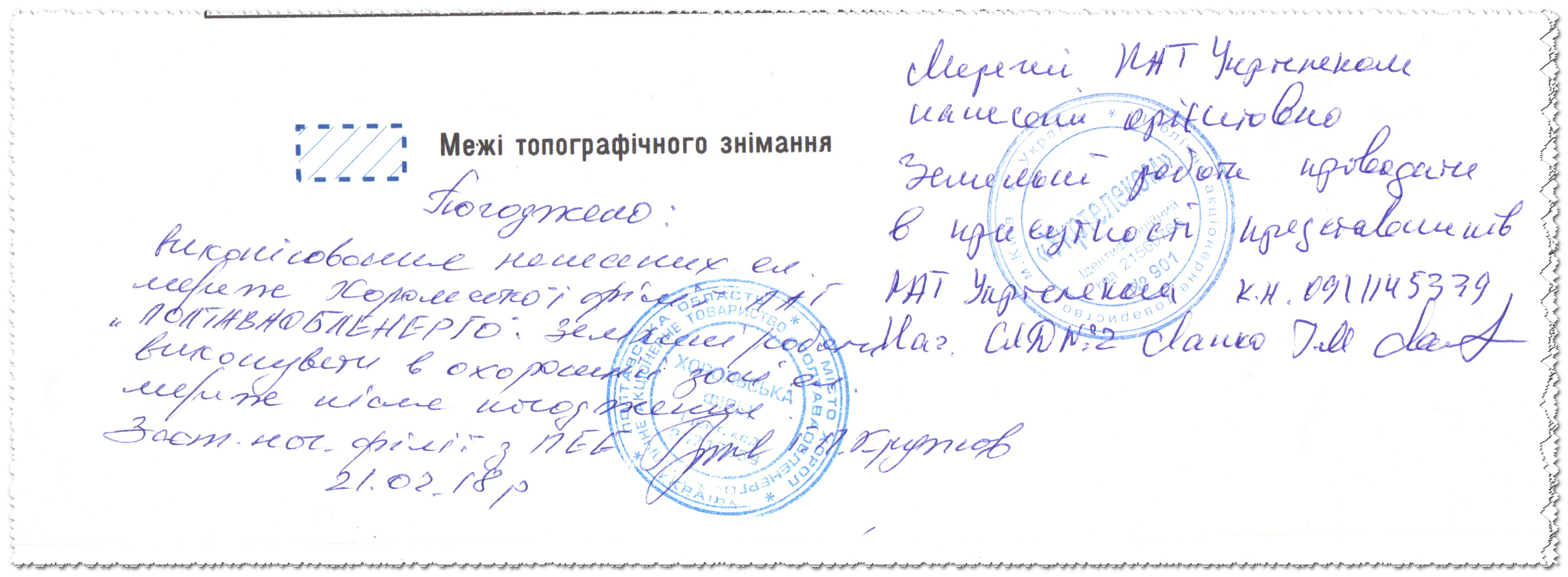
Work examples
The main factors affecting on the cost of work:
The list of tasks that the customer intends to solve with the help of shooting
Area, scale and configuration of the shooting boundaries
The location of the object
Availability of topographic survey materials for previous years